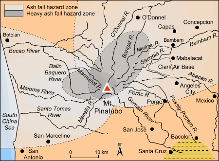
Figure 21c. Hazard maps produced on May 23 1991 before the eruption of Pinatubo volcano. This map shows the ash fall in two differing wind direction and velocity scenarios. Adapted from PHIVOLCS (1991).
go back to the text