
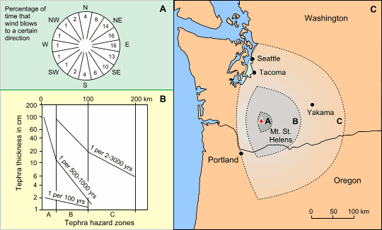
 Figure 15. Tephra hazard map for Mt. St. Helens. A. Wind direction data for the area. B. Expected tephra thickness in the three hazard zones downwind of the volcano based on tephra falls of 1, 0.1 and 0.01 km3. C. Tephra hazard zones. Adapted from Crandell and Mullineaux (1978). |