|
|
||
|
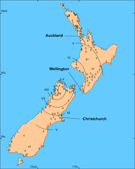
Figure 12. Isoseismal maps for two historic earthquakes in New Zealand. The upper map is for the 1929 Buller earthquake, Ms 7.8, focal depth 20 km. The lower map is for the 1855 Wairararapa earthquake, Richter M 8.2, shallow focal depth (after Aitken and Lowry 1995). |
||